The Claimed Discovery and Oversight
A Google researcher using a team of AI agents claimed to have discovered a potentially unmapped Maya site in Mexico, but the location had already been published in an academic journal the previous year. The incident highlights growing tensions as amateurs using automated tools enter specialist scientific fields without domain expertise.
Methodology and Lidar Scanning
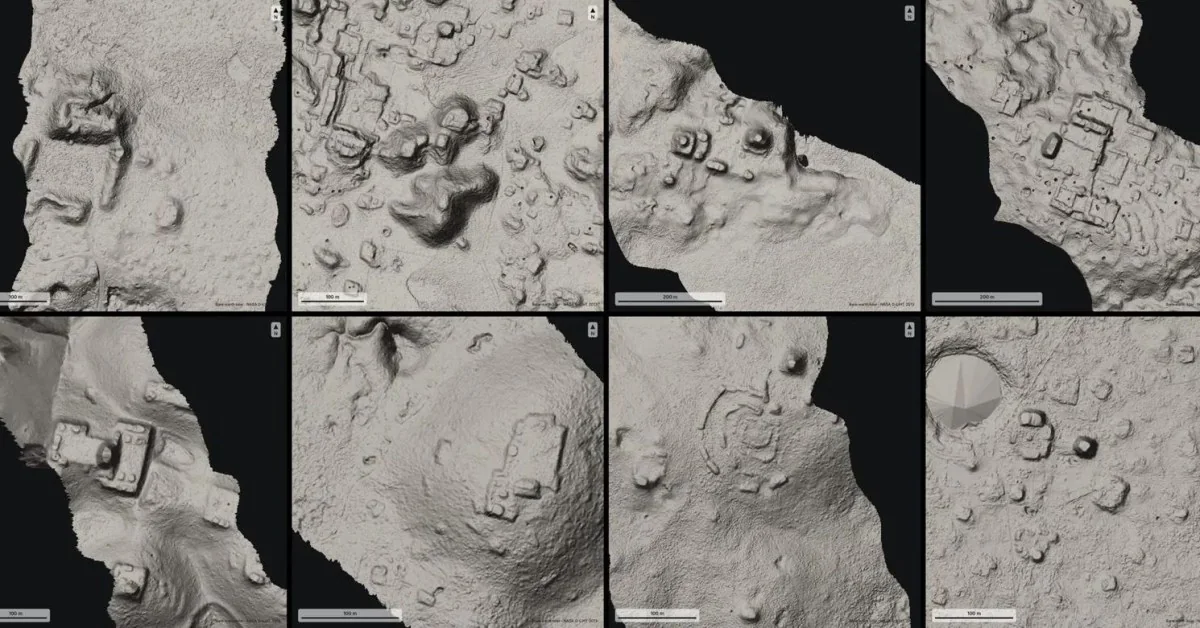
The project began as a personal side project utilizing lidar, a laser-based mapping technology capable of producing three-dimensional environmental models. Deploying a team of 48 AI agents to examine NASA lidar data for undocumented ruins, the project shifted focus to the Maya region due to coverage gaps in public data for Peru.
The automated tools flagged several potential locations, including a major village that appeared unregistered in existing records. The researcher contacted Mexico’s National Institute of Anthropology and History using translated correspondence, and was informed that the agency had no record of a registered site at those coordinates.
The process moved rapidly from concept to government response, prompting public excitement regarding the speed of automated workflows.
Although acknowledging that fieldwork was necessary for verification, the project was initially framed as evidence of a broader scientific revolution. However, regional experts quickly noted that the specific location had been formally documented in academic literature over a year prior.
Expert Criticism and Limitations
Professional archeologists criticized the oversight on social media, emphasizing the necessity of cross-referencing findings with existing literature. Experts noted that an absence from government databases does not equate to an unmapped site, and argued that the incident risked spreading misinformation while overlooking decades of digital tool usage by professional researchers.
The creator acknowledged the limitations of the current technology, noting that checking against academic papers rather than simple databases presents a significant hurdle for autonomous agents. Corrections and updates were applied to the blog post once the oversight was identified.
Despite the error, the developer reported positive engagement from other academic researchers interested in exploring similar data-sorting workflows.
Broader Archaeological Context
Mesoamerican experts pointed out that the primary bottleneck in archaeology is not finding undocumented mounds, but rather securing adequate funding for excavation and physical mapping. Furthermore, researchers noted that local communities are typically familiar with nearby ruins long before digital surveys identify them.
While conceding that interpreting lidar data is complex and the automated mapping was executed adequately, specialists reiterated that financial constraints remain the primary barrier to expanding archaeological knowledge.
Implications for AI in Science
The controversy reflects a wider pattern involving artificial intelligence applications in scientific research. While models frequently generate impressive outputs, they often fail to contextualize findings within existing literature, leading to redundant claims of breakthroughs. This dynamic shifts the burden onto human experts to verify automated outputs.
Coauthors of the original study documenting the site expressed skepticism regarding the utility of the agentic workflow, noting that remote sensing tools have been standard in archaeology for years. They cautioned that government registries are incomplete, making direct institutional checks insufficient for confirming novelty.
Researchers also warned that an influx of unverified automated claims could overwhelm specialists and potentially expose vulnerable sites to the risk of looting if precise coordinates are publicized.